
Turning Drone Data into Decision-Ready Construction Intelligence
Turning Drone Data into Decision-Ready Construction Intelligence
Drones have become a standard tool on modern jobsites—but raw aerial imagery alone doesn’t deliver value. The real challenge is turning thousands of images into insights teams can trust to guide schedules, costs, and risk decisions. AI Clearing was built to solve that problem.
AI Clearing is an AI-native drone analytics and construction intelligence platform designed to convert aerial data into actionable insights across the full project lifecycle, from early earthworks through operations and maintenance. At the core of the solution is AI Clearing CORE, a standalone, web-based analytics platform that acts as a single source of truth by ingesting drone imagery, CAD/BIM designs, project schedules, and mobile field data. By recording and processing commercial drone data at scale, AI Clearing enables organizations to consistently transform raw aerial captures into reliable, decision-ready intelligence.
High-Accuracy Drone Analytics at Speed
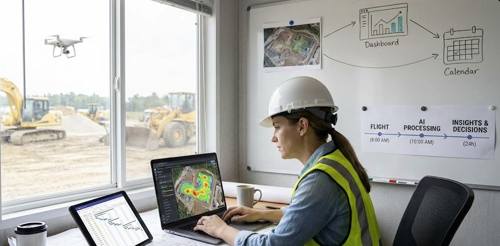
A defining capability of AI Clearing within the Drone Analytics category is its proprietary AI engine, purpose-built to analyze drone data with exceptional accuracy and speed. The platform automatically generates advanced 2D and 3D visualizations, including orthophotomaps, slope and surface models, and design-versus-as-built overlays—delivering comprehensive reports in less than 24 hours after data capture.
Automated deviation dashboards and object detection tools allow users to quickly identify variances, measure distances and areas, and validate site conditions without manual processing or reliance on external business intelligence tools. This dramatically shortens the time from flight to insight and improves confidence in reported conditions.
From Visualization to Production Intelligence
AI Clearing goes beyond traditional drone visualization by delivering volumetric and production analytics tied to real operational outcomes. The EarthCORE module provides high-precision cut-and-fill and stockpile volume measurements, displayed in cubic meters and segmented by location, date, or section.
Heatmaps, dynamic cross-sections, and automated summaries enable construction, infrastructure, mining, and energy teams to quantify material movement, monitor compliance, and optimize production directly from drone-derived data. Instead of static images, teams gain measurable insights that support forecasting, progress validation, and cost control.
A Standalone Drone Analytics Platform Built for Enterprise Use
Designed for enterprise environments and multi-industry deployment, AI Clearing enables users to interact with, analyze, and contextualize aerial insights within broader project workflows. AI-assisted capabilities such as Clara allow users to query drone analytics using natural language, while integrated mobile applications capture inspections, inventory, and field observations that enrich aerial analysis with real-world context.
By offering a standalone, AI-driven drone analytics platform that supports construction, energy, infrastructure, mining, and inspection use cases, AI Clearing aligns fully with G2’s requirements for the Drone Analytics category.
AI Clearing doesn’t just process drone imagery—it turns aerial data into intelligence teams can use to make faster, more confident decisions across the entire project lifecycle.